
The GEORGE project is starting a major deployment of novel measurement sensors for ocean carbonate measurements at the Porcupine Abyssal Plain (PAP) in the North Atlantic. The year-long deployment, set to begin in early June 2025, will be one of the most technically ambitious operations in the project to date. The mission’s main scientific goal is to fully characterise the ocean carbonate system using autonomous technologies.
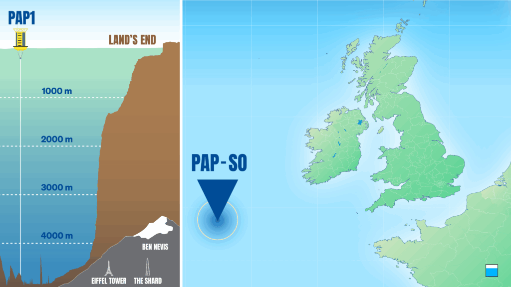
The Porcupine Abyssal Plain (PAP) observatory is located approximately 500 kilometres west of Ireland. Established and maintained by the National Oceanography Centre (NOC), it is known for four decades of ocean monitoring, and is part of the ICOS ocean observing network. A new effort made possible by the GEORGE project will build on that work by enabling high-resolution biogeochemical observations at the seabed and throughout the water column to depths reaching nearly 5000 metres.
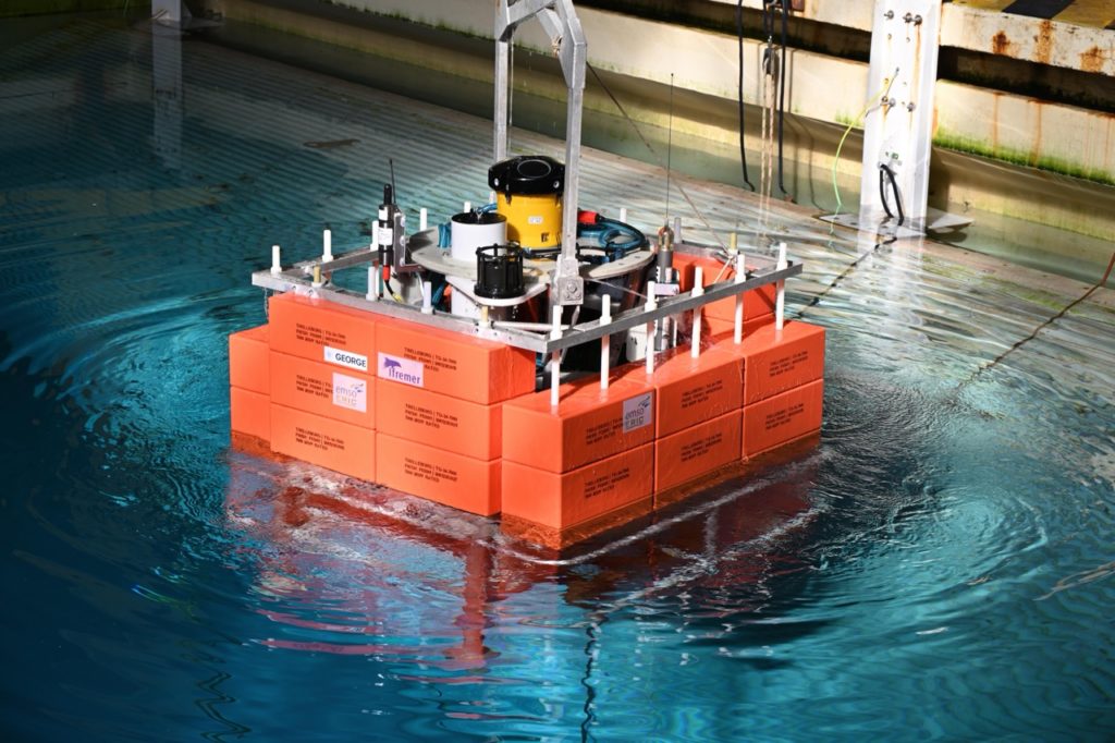
To make this possible, several types of autonomous observing platforms will be used, representing the range of technologies most commonly used for ocean carbon observations. The platforms deployed are the EMSO Generic Instrument Module EGIM, BGC Argo Floats, the SeaExplorer glider, Sailbuoy surface ocean vehicle and a surface mooring.
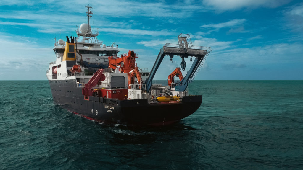
The four-week journey to the PAP site and back will be led by GEORGE partner National Oceanography Centre (NOC), using the research vessel RSS James Cook. After the platforms are deployed, the crew will remain on site for three weeks to conduct the yearly observations and experiments. Sensors and samplers on the EGIM and PAP mooring will remain on site collecting observations until the next visit in June 2026.
Why multiple platforms matter for understanding carbon cycling
The mission’s main scientific goal is to fully characterise the ocean carbonate system using autonomous technologies. This ocean is key in regulating atmospheric carbon dioxide and, by extension, the Earth’s climate. Getting accurate, high-quality and long-term data of relevant parameters—like pH, DIC and TA—can help scientists better understand the ocean’s role in climate mitigation.
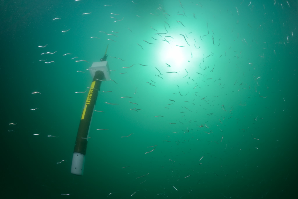
Until now, autonomous platforms have not been capable to directly measure the parameters needed for precise understanding of the ocean carbon system. But that’s changing. GEORGE teams will be deploying new sensors capable of measuring key carbonate parameters including pH, pCO2, dissolved inorganic carbon and total alkalinity, completely autonomously.

The PAP site offers the perfect testing ground. At nearly 5 kilometres deep, it’s one deepest part of the Northeast Atlantic and regularly exposed to harsh conditions, including large waves and winter storms.
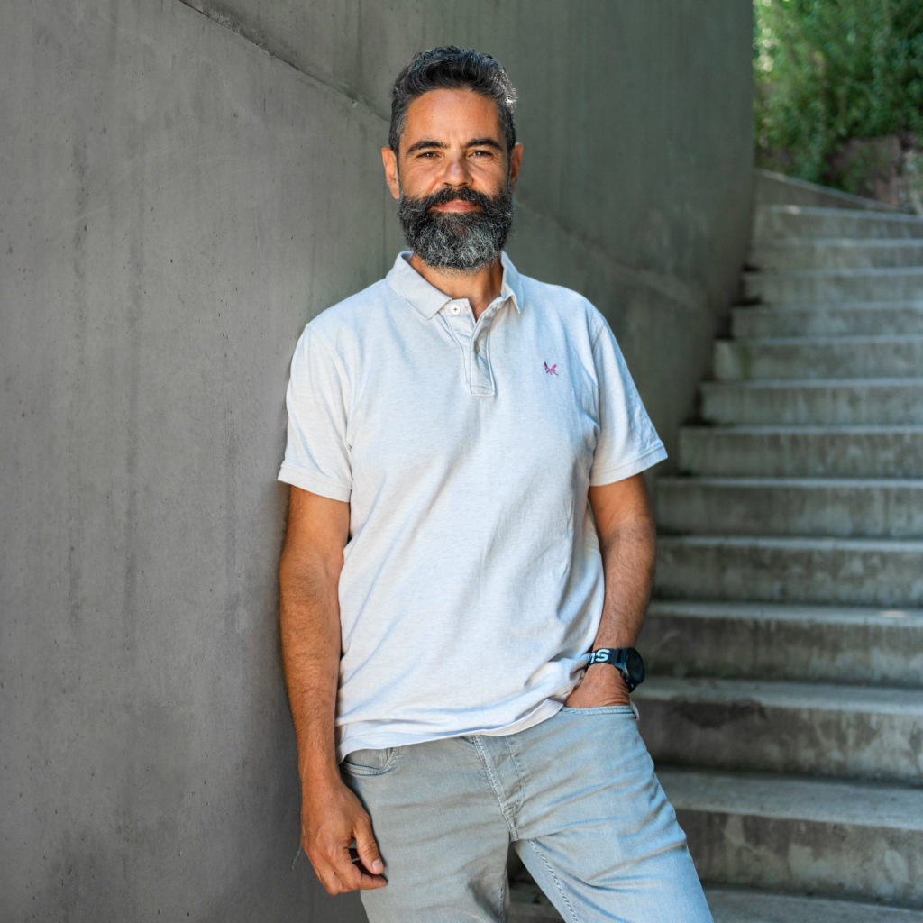
“NOC has maintained monitoring equipment there for 40 years, first at the seabed and later at the sea surface as well. It’s a good site to test new equipment because we already know what to expect”, says Dr Socratis Loucaides, who is in charge of the sensor development in GEORGE. “But then it’s also a challenging place exposed to big storms and massive waves, a real test for the robustness of autonomous equipment.”
A unique and exciting aspect of this deployment is that it will bring together multiple autonomous platforms at the same location, measuring the ocean carbon system across the water column in time and space. This will allow scientists to contrast surface measurements with those taken at the seabed, and throughout the 5000 m water column using gliders and profiling floats.
“Measuring across multiple platforms lets us understand carbon cycling in several dimensions—horizontally, vertically, and over time,” Socratis Loucaides says. “We will also be looking at data consistency between different platforms. Measuring on several platforms will also offers redundancy in case something goes wrong with one platform.”
Some of the sensors can even measure several parameters at once. That’s a key feature, as autonomous platforms are limited in size and power availability, so the sensors need to be compact and efficient.
Campaign will offer chance to test new innovations
Despite the stress, there is also some real excitement in the air. The deployment will give the international teams of scientists the possibility to test, for the first time in this scale, different technological innovations. The teams have, worked hard to make sure the technology has been able to meet the cruise date.
One such innovation is the CaPASOS system, a sensor that can measure surface ocean CO₂ concentrations from an autonomous vehicle. CaPASOS will make it possible to gather data from remote areas of the ocean that aren’t otherwise easily accessible.
The CaPASOS sensor will be integrated on the Sailbuoy, an autonomous surface ocean measurement platform, which will travel a 1,000-kilometre journey from the Irish coast to the PAP site. Powered by the wind and navigated from shore, it will measure surface water CO₂ concentrations along the way.
Also on trial is a new system for autonomous water sampling, which is used for validation and calibration of sensor data.
“Autonomous samplers can collect and preserve samples at pre-specified points in time from places that we cannot visit more than once per year. Integrated on the PAP mooring will enable us to validate our sensor measurements”, Socratis Loucaides says. “This is key because some autonomous sensors can drift over time, often deeming their data unreliable over long deployments. Having samples automatically collected and preserved at regular intervals and later analysed in the lab means that we can validate or even correct the sensor measurements .”
Setting the grounds for future innovations
At the end of the year-long deployment, the teams of scientist and engineers will have in their hands not only valuable data on the ocean carbonate system, but also important information on how the autonomous platforms and sensors performed under the immensely challenging conditions often encountered at the PAP site. While this particular deployment won’t be utilising cross-platform communication, it’s an ambition of the global observing community as it will enable a more adaptive and efficient mode of autonomous observing.
“At this stage, we don’t have the capability for cross-platform communication and autonomous decision making. Instead we will be communicating with each platform independently. However, based on what we learn, we hope to come with some recommendations on how platforms should communicate with each other in order to observe what is needed and adapt their observing behavior dynamically”, Socratis Loucaides says. “The ultimate ambition for the future, is to have platforms communicate with each other and adapt their behavior based on what is happening in their environment and what other platforms in the vicinity are doing.”
The PAP deployment will also give the teams unique information on various technical aspects, including sensor performance, especially in relation to long-term stability in deep-sea conditions. At the end of the mission, all collected data on the ocean carbonate system will be carefully analysed and eventually made publicly available.
What would Socratis Loucaides, then, as the lead of the mission, consider a success for the deployment?
“Being able to characterize the carbonate system autonomously over a whole year would be a big success, but so would be sending an autonomous surface vehicle from shore and measuring all the way to the PAP site and back, or 12 months of autonomously collected and preserved samples for carbon analysis. But demonstrating that all these technologies can work in unison and produce valuable in situ observations for understanding ocean carbon cycling – that will be the ultimate success”, he concludes.
Want to stay updated on the latest developments? Follow GEORGE on LinkedIn, BlueSky and X to hear more news about the deployment!